

What I once described, from this topographic map, as an artist's last, angry brushstroke Tocqueville describes:
When we cast our eyes upon the map of the United States [with 24 states] we perceive the chain of the Alleghany Mountains, running from the northeast to the southwest...and we are led to imagine that the design of Providence was to raise between the valley of the Mississippi and the coast of the Atlantic Ocean one of those natural barriers which...form the necessary limits of different States. But the average height of the Alleghanies does not exceed 2,500 feet; their greatest elevation is not above 4,000 feet; their rounded summits, and the spacious valleys which they conceal within their passes are of easy access from several sides...No natural barrier exists in the regions which are now inhabited by the Anglo-Americans; the Alleghanies are so far from serving as a boundary...that they do not even serve as a frontier to the States. New York, Pennsylvania, and Virginia comprise them within their borders, and they extend as much to the west as the east of the line.
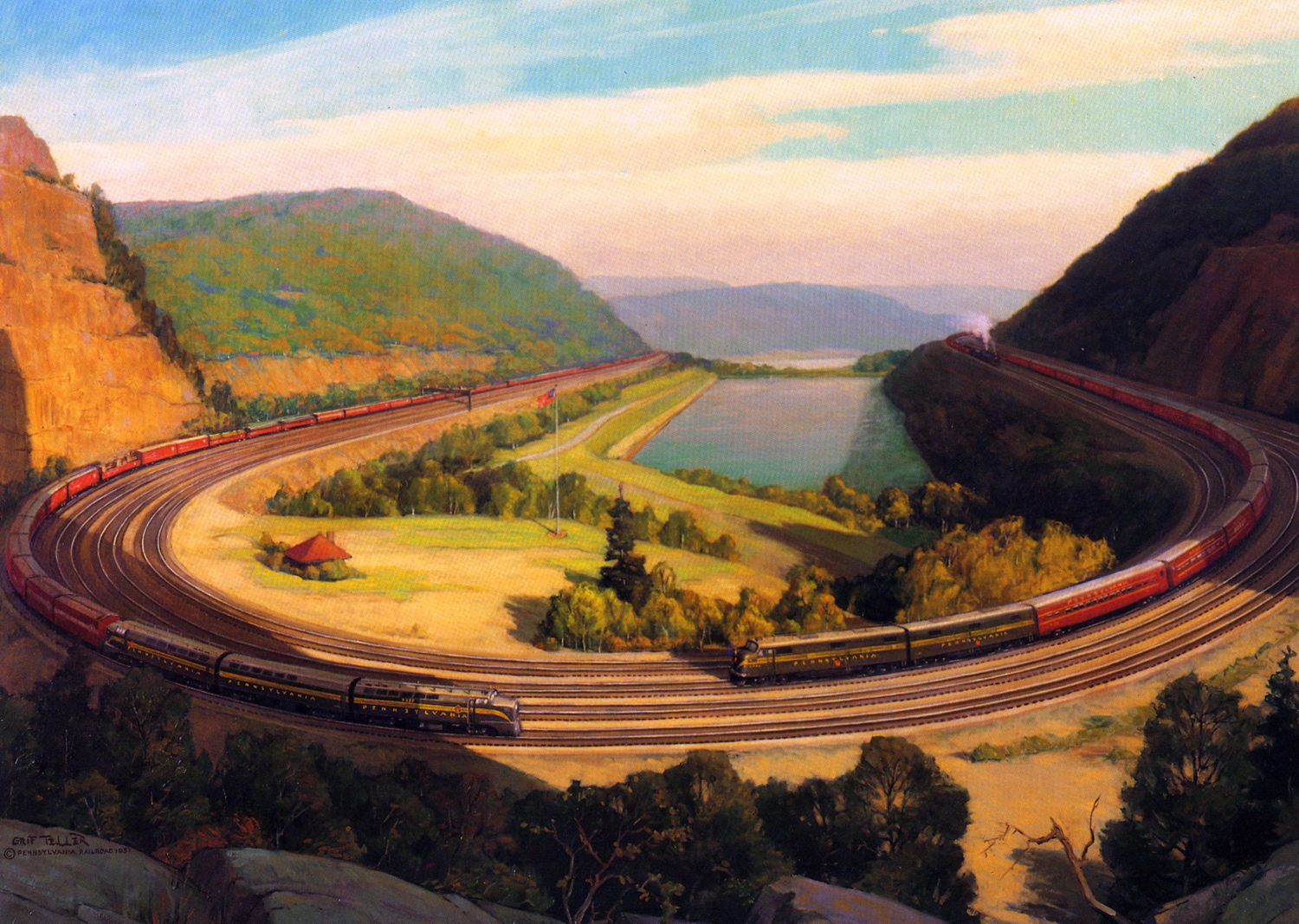
Everything is true except "easy access from several sides." The Alleghenies were a bitch to get over.

Pennsylvanians tried going through them; they tried going down south and coming up around them that way; they tried canals;

they tried portages (Dickens described traversing the Alleghenies past Johnstown via portages); they corkscrewed the mountains with rail when steam locomotives made it practicable. Rail worked.

All of these efforts were hugely expensive and took decades. From Wikipedia:
The near west, in the fifty years before 1830 was but recently settled and steadily growing...The canal era began in Pennsylvania in 1797...Spurred by construction of the Erie Canal (construction between 1817 and 1825)...Pennsylvanians built hundreds of miles of canals during the early decades of the 19th century...By 1834, the Main Line of Public Works, a system of interlocking canals, railways, and inclined planes, was hauling passengers and freight up to 391 miles (629 km) between Philadelphia and Pittsburgh. Though not all in concurrent operation, the total length of the canals built in Pennsylvania eventually reached 1,243 miles (2,000 km).


The Allegheny Mountains did not mark the limit of the states of Pennsylvania and New York, Tocqueville is correct again but they did of Virginia. During the Civil War western Virginia broke off and the new state of West Virginia, loyal to the Union, was created and recognized. Mountains, even ancient ones with rounded summits, do that: they create a different people, a different culture. The undersigned does not know how it is in New York state but in Pennsylvania the Allegheny Mountains created a different, not separate, culturally, economically, climatically, even dialectically, distinct region denominated: Western Pennsylvania. Politically, according to James Carville, "Pennsylvania is Pittsburgh and Philadelphia with Alabama in between." Carville is partly, only partly, correct in that, which I include here only because it cracks me up.
Geography is not destiny, biology is not destiny, etc. But geography affects man's ability to work nature, and to control man, more so than does biology and thus effects a people's destiny more.


